|
'Cold hearted orb that rules the night, The Moody Blues, Days of Future Passed |
Assignment:Reading: Explorations, pp. 28-34
Sign up for a time slot for Observing Lab #1. Problem Set #1 is due Thursday, 1 September. |
In Class:
A Graphical Approach to Determining a Star's AltitudeCutaway Earth Diagram
The Rotation of the Sky
Finding the Altitude of the NCPAnother Cutaway Earth Diagram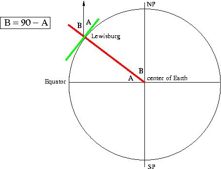
|
![]()