|
By Linda Brake Meyers, July and August, 2000 All photos by Linda Brake Meyers
|
|
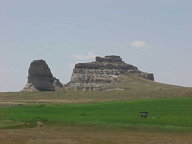
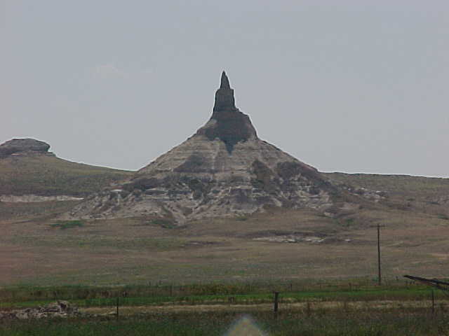
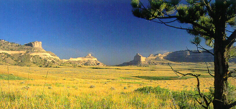
Located near Bridgeport, Nebraska, these are two of many famous landmarks for the traveler on the Oregon trail. Tradition says that they were so named by emigrants who believed them to resemble public structures "back home".
|
Chimney Rock was the most described natural feature in migration pioneer diaries. Located 23 miles east of Scottsbluff National Monument. All diaries of the early travelers show that it was visible for 40 miles and was used as an objective by the slow moving covered wagons.
|
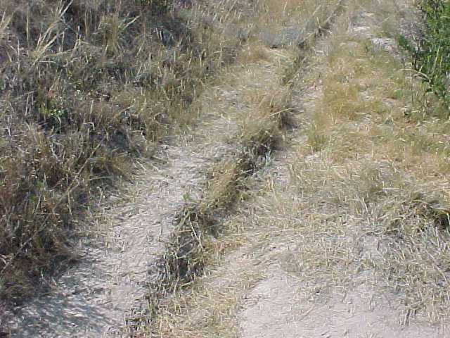
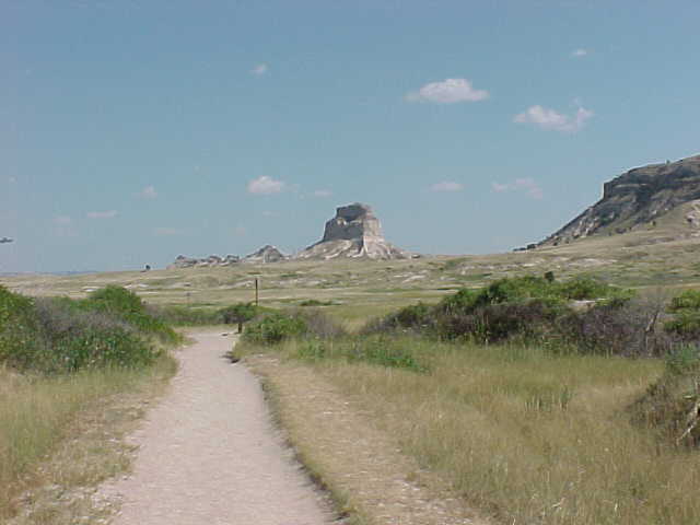
Remnants of the trail still visible at Mitchell's Pass, Scotts Bluff National Monument, Scottsbluff, Nebraska
|
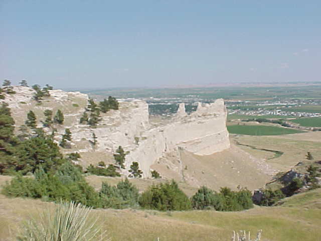
Scene from the top of the bluff. There is a 1.5 mile long paved road which passes from the visitor center through three tunnels to the summit of Scott Bluff. Overlooks on the summit afford a panorama of the North Platt Valley and distant Chimney Rock and Laramie Peak.
|
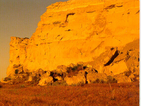
Dome Rock at Scotts Bluff, looking east from Mitchell Pass.
|
Sentinel and Eagle Rock at Mitchell Pass , Scotts Bluff National Monument
Mitchell Pass was the main route for most California and Oregon pioneers after 1850. The Pass was also the route through the hills for the military, the Overland Stage, Pony Express and telegraph lines.
|
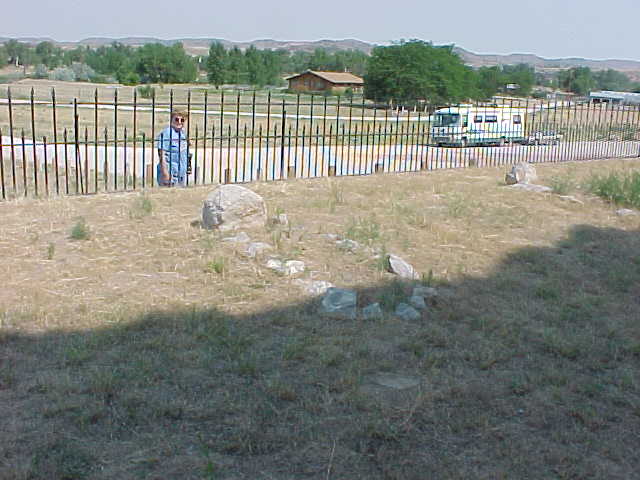
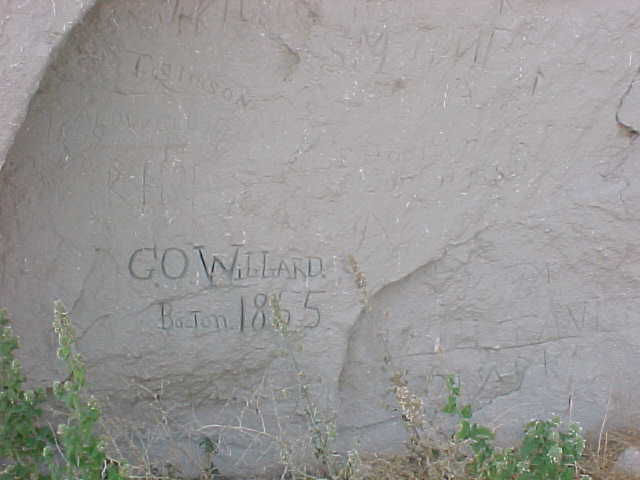
Just west of Fort Laramie on Highway 26 is the small community of Guernsey, Wyoming. South of town is Register Cliff and the Oregon Trail ruts. Both are national historic landmarks and there is no admission fee. At Register Cliff, the Oregon/California bound travelers would stop briefly to carve their names on the soft sandstone cliffs above the North Platte River. Signatures and dates are still visible, along with many which have been added by tourists over the years.
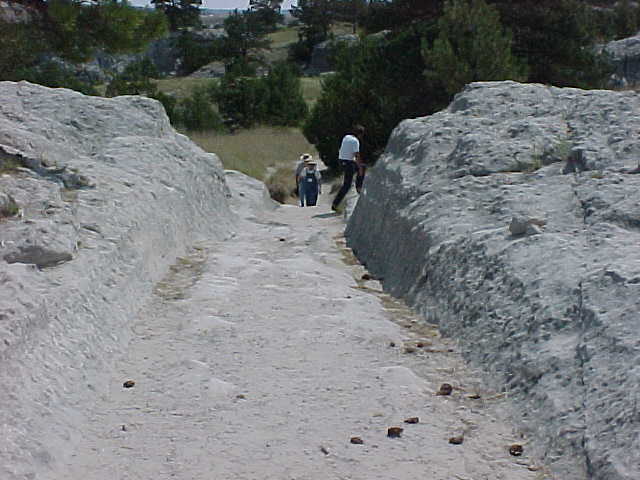
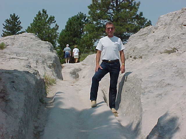
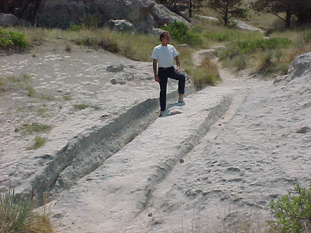
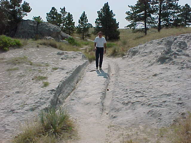
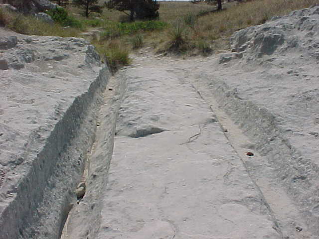
Just a few miles west of Register Cliff are the most remarkable Oregon Trail ruts one can hope to see. There is a parking area and a walk of several hundred yards to the ruts. You can stand in the ruts and follow the trail on foot for a short distance.
|
There are several graves marked with fieldstones in a fenced in area at Register Cliff.
|
|
|
Notice how the wagons have worn down the soft sandstone to form a cut more than 3 feet deep. See side of stone near Lee's left hand. The center was worn down by the wagons' axles and tongue. The center groove was made by the feet of the pioneers as they walked behind the wagons.
|
|
|
|
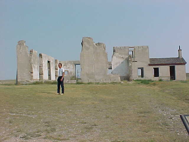
Fort Laramie's setting on the approaches to the Rocky Mountains looks much as it did when the post was the center of activity in the area. Located 3 miles southwest of the town of Fort Laramie, Wyoming off U. S. Route 26.
As America expanded westward, this outpost in the Wyoming wilderness played a crucial role in the transformation of the West, first as fur-trading center, then as military garrison. For over five decades, it was a landmark and way station for the cavalcade of trappers, traders, missionaries, emigrants, Pony Express riders, and miners wending their way west. It was also an important staging point for the U. S. Army in its dealings with the plains tribes displaced by migration and settlement. Founded by William Sublette in 1834 as a trading post "Laramai's Point" became a military post for the government during the 1850's and 1860's. The Great Migration of 1843 brought close to a thousand people to Fort Laramie and throughout the 1840's wagons increased in numbers peaking in the 1850's to 50,000 annually. Fort Laramie was one of the few supply points on the long journey. (From Brochure of National Park Service, U. S. Department of the Interior).
Photo is of the Hospital Ruins (1873) which was built on the site of the old cemetery used by the army until 1868. Its 12 beds were enough for most situations but were inadequate when an epidemic hit the post. The hospital contained a dispensary, kitchen, dining room, isolation rooms and surgeon's office, but no labs or operating rooms. Future plans are to restore the hospital and use as a visitors center.
|
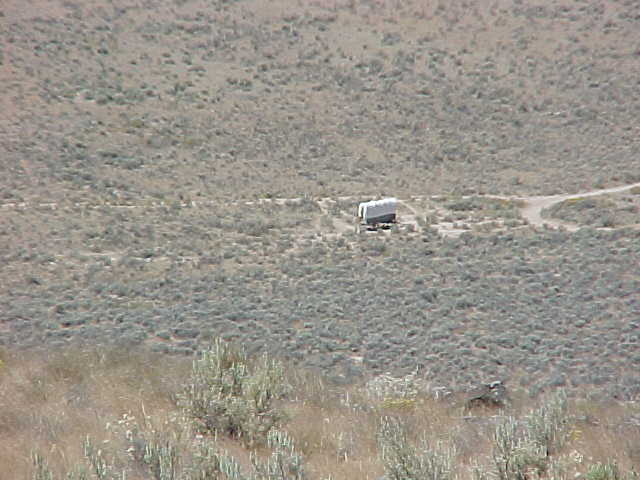
National Historic Oregon Trail Interpretive Center near Baker City, Oregon.
Looking down at the Oregon Trail from Flagstaff Hill, the visible part of the trail is to the left of the covered wagon. The covered wagon sits on a seven mile remnant of the trail.
|
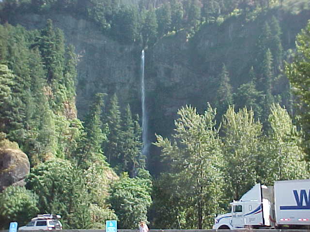
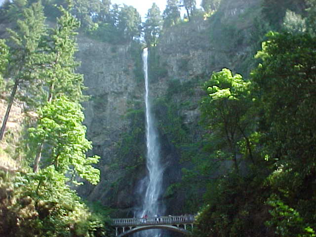
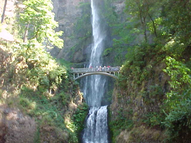
Located in the Columbia River Gorge, the Multnomah Falls flows over cliffs, creating a drop of 620 feet.
|
|