Flooding in the Susquehanna Watershed
Since record-keeping began 200 years ago, the Susquehanna River has proven one of the most flood-prone watersheds in the nation. The watershed encompasses 27,510 square miles and extends from New York to Pennsylvania to the Chesapeake Bay in Maryland – where nearly 4 million people live.
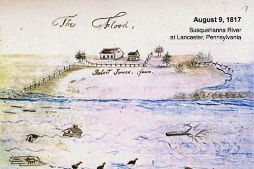


The main stem of the Susquehanna has flooded 14 times since 1810 – about every 15 years, on average. Even the Native Americans who once lived in the area told of frequent floods.
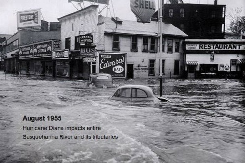
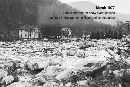
MAJOR HISTORIC SUSQUEHANNA FLOODS


The Susquehanna Basin also is vulnerable to frequent, localized flash floods every year. These flash floods, usually affecting smaller tributaries, can occur with little advance warning.
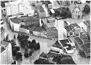
Tropical storm Agnes in 1972 caused the worst recorded flooding in the basin. Seventy-two people died and damaged topped $2.8 billion – about $14.3 billion in today’s dollars. Flood levels exceeded the record levels of the 1936 flood by as much as six feet in some places. It was the nation's most costly natural disaster until Hurricane Andrew hit in 1992 and Hurricane Katrina in 2004.
Of the 1,400 communities in the river basin, 1,160 have residents who live in flood-prone areas. For these residents, flood warning and flood management and protection are of utmost concern.
FLOOD-RELATED WEBSITES
• Sunbury Municipal Authority Flood Control
• Hurricane Agnes - 40 years later
(NOAA/National Weather Service)
• Newpaper coverage of Tropical Storm Lee
• Hurricane Agnes - 40 years later
(NOAA/National Weather Service)
• Newpaper coverage of Tropical Storm Lee
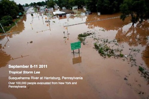
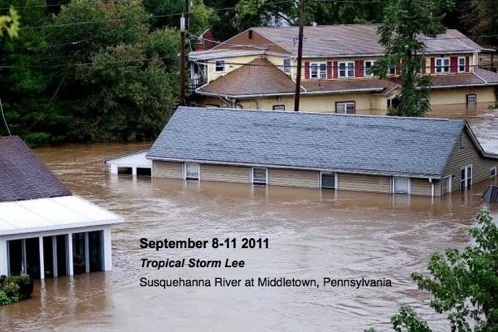
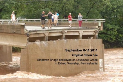
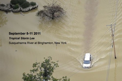
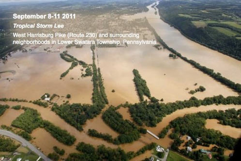
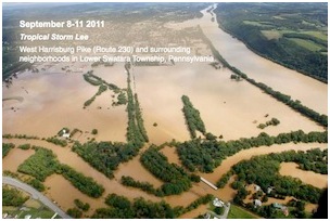
IMPACT OF TROPICAL STORM LEE
September 8-11, 2011
September 8-11, 2011
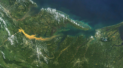
Satellite view: The sediment plume from Tropical Storm Lee and Hurricane Irene is clearly visible in this image taken by the Moderate Resolution Imaging Spectroradiometer (MODIS) on NASA’s Terra satellite on September 13. North is to the left.

Susquehanna River: A satellite view of the Susquehanna River near Harrisburg, Pennsylvania, on September 10 shows the high levels of sediment that are being carried toward Chesapeake Bay. This natural-color image is from the Advanced Land Imager (ALI) on NASA’s Earth Observing-1 (EO-1) satellite.
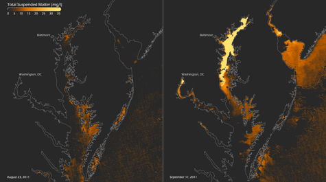
Chesapeake Bay Before and After: NASA's Aqua satellite captured these views of suspended matter (silt, mud, debris)in Chesapeake Bay before and after the passage of Hurricane Irene and Tropical Storm Lee. Image courtesy of NOAA CoastWatch.
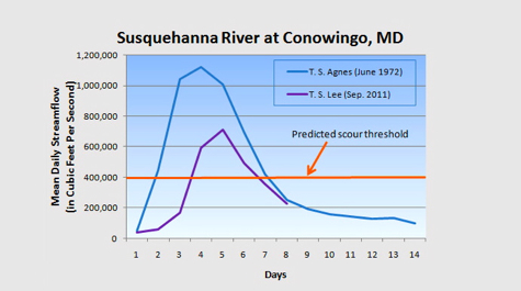
Susquehanna Streamflow: Mean daily streamflow for the Susquehanna River at Conowingo, Maryland, resulting from Tropical Storms Agnes and Lee. Image courtesy USGS.
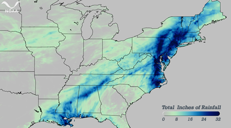
Irene/Lee Rainfall: Total rainfall from August 26 – September 9, 2011, as analyzed by the National Weather Service’s River Forecast Centers. The largest rainfall totals, almost 3 feet so far, are seen in Northern Virginia through New York. Image courtesy of NOAA.
Historic Flood Levels
Harrisburg, Pennsylvania

Susquehanna River Symposium