Susquehanna River Initiative
Bucknell University Environmental Center
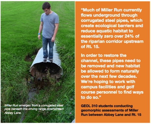
Restoring the channel and floodplain features
Fluvial process-based geomorphic design
R. Craig Kochel, Professor of Geology
Benjamin Hayes, Environmental Center
Benjamin Hayes, Environmental Center
Aquatic ecosystems are directly linked to the physical dynamics of the fluvial system - the geomorphology and hydrology. Too often, because of limited time, experience, and budgets, very little pre- and post-construction monitoring is done for most stream and wetlands restoration projects. As a result, the complex dynamics are not understood and the constructed aquatic habitats remain essentially sterile, colonized by invasive species, and disconnected from the stream and hyporheic exchange. Base flow remains low in the channel and aquatic ecosystems show little signs of improvement of time.
Also, the stream restoration industry commonly uses Natural Channel Design methods which usually realign the stream to a meandering pattern and rely upon rock and wood structures to create artificial pools and “lock” the gradient and width of the channel. This hardened approach is expensive and not sustainable over the long term.
NCD veins and weirs also prevent lateral migration of streams, which is a natural fluvial process and necessary to create diverse aquatic habitat and allow the fluvial system to evolve.
In 2009, Bucknell’s Susquehanna River Initiative offered a public workshop on Geomorphic and Biologic Factors to Consider in Stream Restoration, which brought together scholars, consulting engineers, fisheries biologist, and regulators from PennDOT, DEP, EPA, and the USGS. An outgrowth of this workshop was a consensus that restoration projects need to incorporate an approach based upon fluvial process, not some idealized form.
That’s the approach being used by students in UNIV 298, GEOL 301, GEOL 310, GEOG 332, AND CENG 421 courses. This a multi-disciplinary effort to characterize the current conditions Miller Run, determine the prehistoric state of the watershed, measure and compute the degree of impairments to the hydrologic, geomorphic, and ecologic components.
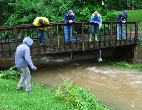
GEOL 310 students collecting suspended sediment samples in Miller Run during storm water runoff event in September 2011. This information, combined with channel morphology and discharge and velocity data is invaluable for determining the source areas of the water and sediment and designing new stream channels. [photo: Ben Hayes]
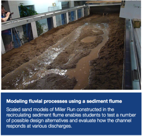
Physical modeling of restoration alternatives
Flume experiments provide insight on how channel form may evolve over time
Geol 310 students
Simplified sand models of three reaches of Miller Run were set up in the Geology Department’s recirculating sediment flume. The sediment consisted of a fine sand - clay mixture to mimic a variety of current and post-construction shapes.
Channel features such as root wads, gravel bars, riffle weirs, and floodplain terraces, wetlands, and flood bypass channels were also placed in the flume channel. Water was then introduced at various discharges to mimic baseflow, bankfull, and flood conditions.
The flume experiments were helpful in visualizing how the channel evolves over time and adjusts to varying flow conditions. They also help the students evaluate and refine their design ideas, especially on ways to configure the channel floodplain following excavation of fill areas or removal of pipes and bridges.
Many more flume models can be constructed in the future, to experiment with a wider range of sediments, channel slopes, widths, and other aquatic habitat elements.
Many more flume models can be constructed in the future, to experiment with a wider range of sediments, channel slopes, widths, and other aquatic habitat elements.