Susquehanna River Initiative
Bucknell University Environmental Center
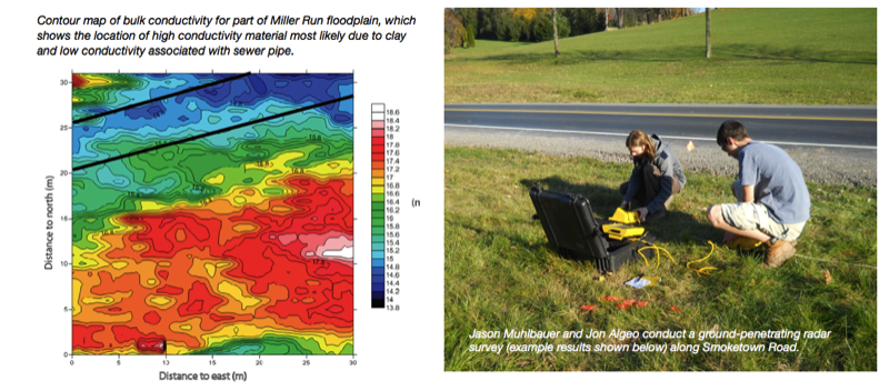
Mapping the subsurface
Using innovative, non-invasive geophysical technologies
Dr. Robert Jacob, Assistant Professor of Geology
Thirteen students in the Environmental Geophysics (GEOL 301) used a variety of noninvasive geophysical techniques to map the shallow subsurface along Miller Run to depths of approximately 8 m.
Students collected data and compared the results of five geophysical mapping techniques: (1) seismic refraction unit, (2) electromagnetic, (3) magnetics, (4) electrical resistivity, and (5) ground-penetrating radar.
Students collected data and compared the results of five geophysical mapping techniques: (1) seismic refraction unit, (2) electromagnetic, (3) magnetics, (4) electrical resistivity, and (5) ground-penetrating radar.
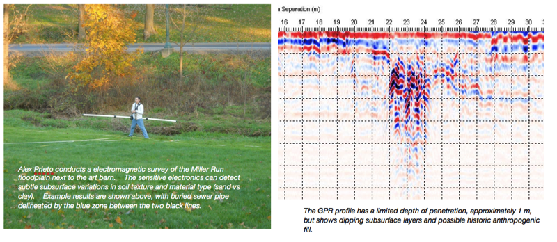
These results provided both changes observed across a mapped region and floodplain cross sections. This information is critical for both construction (re-contouring the channel floodplain to a more original condition), avoidance of subsurface infrastructure, and removal of fill upstream of the Art Barn bridge.
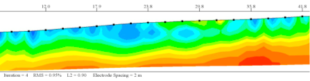
The electrical resistivity image (above) shows the thickness of the unconsolidated near surface material (blue colors; low resistivity values) increase from right to left as one approaches the Miller Run stream channel (far left side of figure).